Deja Vu ... All Over Again
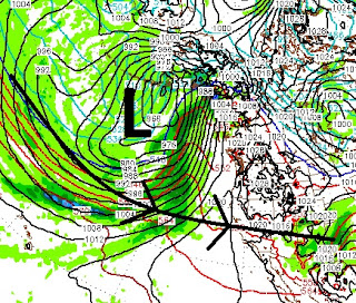
The party gets going again around noon on Thursday. A massive storm which is centered well to our north will spin up at least 5 smaller storms and throw them right into the entire state of California, including Tahoe.

Like we have seen for the last month and a half, these storms have plenty of subtropical moisture to work with.
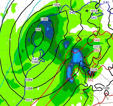
Here is the forecast for Thursday at noon:

As these storms tap into the subtropical moisture, they will come in warm. As they exit they will pull down cooler air ... until the next system arrives. So look for around 8,000 feet on this first storm, with snow levels coming down to around 5,500 feet as we get on the back side.
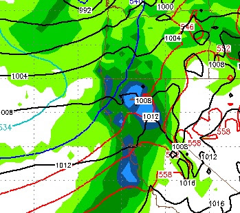
Then, late Friday night, we have a split condition. The storm will split with the moisture tap partially broken for Tahoe, but on full display for Central and Southern California:

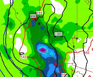
The next storm shows up around Sunday at noon. This storm will pull more air from the north and less from the south, which means far less precip, but possibly all snow above 6,500 feet.

Notice the cooler air coming from more of a western/north western trajectory. The next storm, which I think is the most impressive of the bunch comes in next Tuesday, very early morning (2/21).

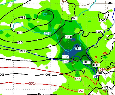
This storm will come in warm (8,500) but should quickly cool. This is the slowest moving storm of the bunch. It will be around for about 36 hours and when it exits, high pressure will move back in ... temporarily.
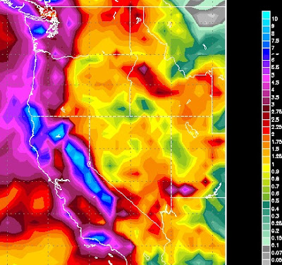
Here is the precip forecast for the event:

Again we are looking at many areas along the Sierra crest to pick up 10+ inches of liquid precip, I oftentimes ponder to myself, when will this rainy season wind down?
I think we are looking at a good 3-6 feet of snow for the Carson Range.
Stay Tuned ...