When Will it Snow?
High Pressure is dominating our weather. The ridge of high pressure to our west has done some dancing, but for the most part is blocking any moisture from getting into our area. In our last post we forecast that will change around the 18th - 20th. It does look like our ridge will begin to see some movement and a storm will probably just graze our area. However, toward the end of the month we are seeing major movement of the ridge and possibly a large storm could be headed our way. About Time!
First here is a look at where we are today:
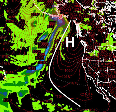
Notice as our ridge moves north, our weather warms. Expect warmer conditions over the course of the next week or so. This ridge is literally blocking 90% of the North American coast.
We are seeing on several different models a break down of the ridge as it moves out to sea and allows storms to move in. Here is a forecast for the 18th:
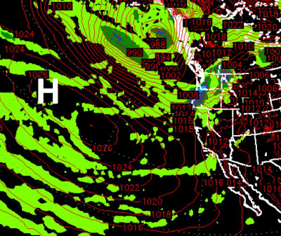
As the ridge moves out to sea, the storm door will open for our area. The first in a what should be a series of storms will come our way around the 18th - 20th. However, the models are forecasting the bulk of this storm to stay north of us.
As the door remains open, we are seeing a major event that could last for quite some time for the entire state of California. Here is the forecast for the 29th of November as our ridge stays well west and out of the way:

We talked about a late start to winter. However, we still believe that we will make up for the late start with a very snowy December and January.
Of course, Mother Nature always has the last say. We are talking about forecasting 3 weeks out and a lot can change. Having said that, the models, especially the European Model, have become much more accurate with long range forecasting so we are relatively confident that winter will get going in about 10 days or so.
Stay Tuned ...