Time for the Something Decent; Huntington see's Wet April
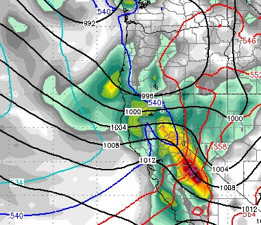
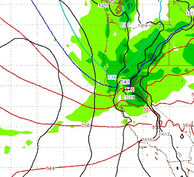
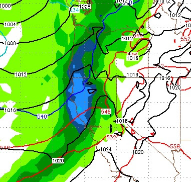
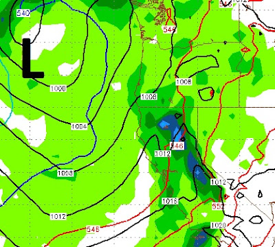
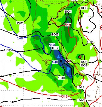
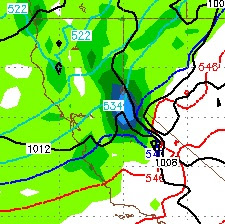
If you read the last post, we are now approaching what we termed a decent storm. Here are the details: Approaching storm will mean above average temps tomorrow as storm's counter clockwise rotation brings in sub-tropical air. Thursday starts out warm, but as storm approaches, temperatures begin to drop and winds begin to increase, especially Thursday afternoon. Very early Friday approaching storm reaches Sierra and has a very adequate moisture tap. Moisture should be moderate to heavy through Saturday as this storm is moving much slower than the last series of storms. Storm could produce as much as 10 inches of liquid precip at the Sierra Crest South around Mammoth and up to 5 inches in the Carson Range. That classifies this as a very strong spring storm. Here is a look at the GFS forecast for late Friday night as the storm peaks around then: Here is a look at the total precip. Some areas of the Central Sierra could pick up 10+ inches of liquid precip, which would