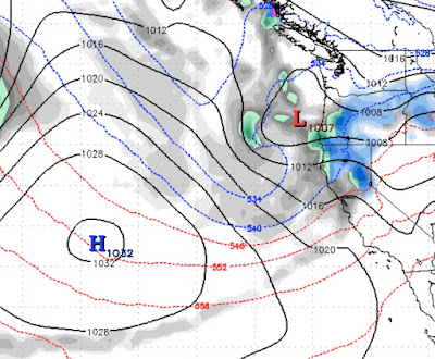
As Ridge Moves West Expect Major Pattern Change
The models have been pretty consistent these past few days. Somewhere around the 13th of this month, about a week from today, we expect our blocking ridge of high pressure to move south and west. That will open a storm door and at least for now, it looks like the storms are going to come right in!
As with most pattern changes, the storms will start fairly weak and become progressively much stronger. Remember the days when the week of Christmas brought powerful storms into the Tahoe area. Well if things hold together, we are going to have a very stormy several weeks leading up to Christmas.
Cross your fingers as all of Tahoe is in the 6-12 inches of liquid precip.
I was up the mountain today and we can really use the snow. Think positive Tahoe! Continue to be overly nice to your fellow human beings, as that sort of positive energy will always work for the better.
If you are interested, you can follow us on Instagram at TahoeWeatherBlog.
Stay Tuned ...


