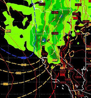
Deep Cold Low Pressure System Heading Our Way. Valley Snow on Tuesday?

If you enjoy the warm weather, do not get too acclimated. That is because an unusually large storm is coming straight out of the Gulf of AK and heading for your backyard. We have one more full day of above average temperatures. Then on Sunday, starting in the afternoon, the winds will start to increase ahead of this large storm. There should be a decent precip event for the Sierra around Tahoe and there is a very good chance of rain and then snow spilling over to the valleys. The snow will come down to 4,500-5,000 feet. Crazy to imagine we had a big storm in January with 11,000 foot snow levels and this one, which will start as all rain, will bring valley snow in June! Here is a quick peek at the forecast for very early Tuesday morning: Of course there is not enough energy for any accumulation and the ground is very warm. However, just the idea that it could hit 95 today and then be in the 30's for highs (in the Sierra and foothills) on Tuesday is pretty amazing. Blame that bi