The Pineapple Express
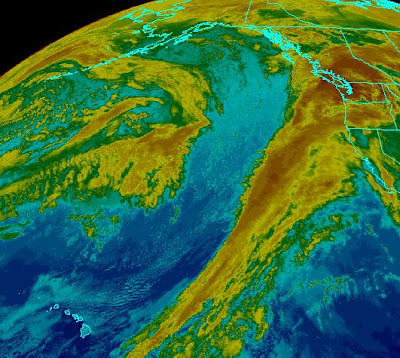
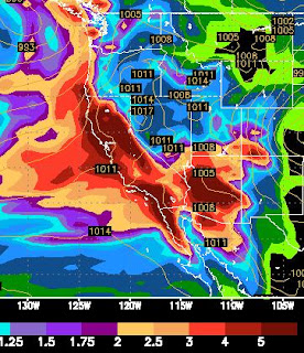
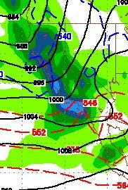
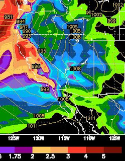
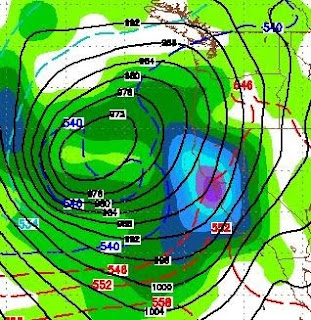
Oftentimes we have heard about a weather anomaly in Tahoe called the Pineapple express. That anomaly is a combination of many factors including the southern jet stream and sub tropical moisture plume. For the most part it represents a huge swath of precipitation stretching from Lake Tahoe all the way to Hawaii. Get the picture? No? Here take a look: This moisture is stretching a little too far north for us to see the epic storm conditions that normally happen in a Pineapple Express. Last Storm in The Cycle As you can clearly see, however, we are not done. In fact the largest storm is about to come in an blast us starting this afternoon and lasting through most of Thursday. This storm should bring us an additional 3-5 feet over the crest. That should translate to around 2-4 feet at Mt. Rose in the Carson Range. Believe it or not, the majority of energy for this storm is heading well south of us. We are on the northern edge of the storm. Here are the totals for this storm alone: