Warm Wet Storm Starts Wednesday Goes Through Weekend
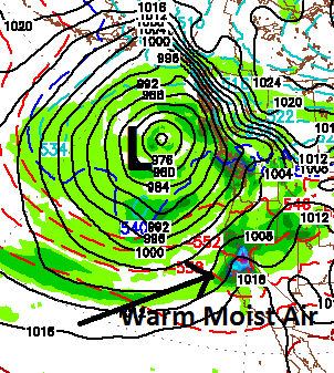
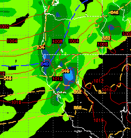
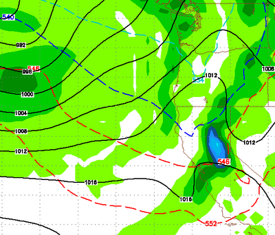
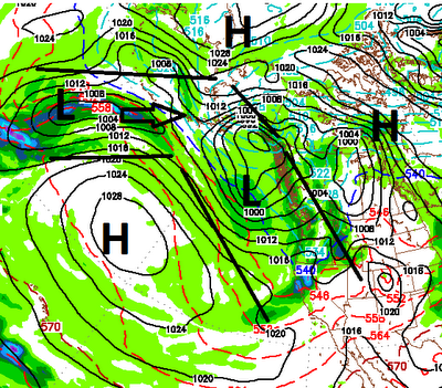
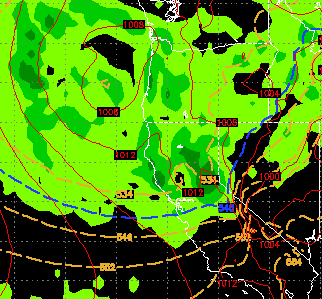
A large storm will pick up ample sub-tropical moisture and should bring very wet weather to the Sierra and Western Nevada. This one is tricky to say the least. As of now, it looks like snow levels could be as high as 9,000 feet for most of this event as the storm taps into a very warm moisture flow from the south. Much of the Sierra could pick up in the 6-10 inch range (liquid precip). If those snow levels could drop down to 8,000, this will build a terrific base in the higher altitude ski areas, like Mt. Rose and Mammoth. The lake level areas like Squaw Valley will see almost all rain on the lower mountain as things look right now. I have charted what is forecast by the GFS weather model for Saturday. There is a giant storm to our north that is picking up sub tropical moisture from our southwest and bringing that to Tahoe and especially the western crest of the lake. Bands of heavy precip will start Thursday night and last through Sunday. The valley's will pick up much need