Dry Cool Weather Until Next Weekend, Then Good Chance for Winter Storm
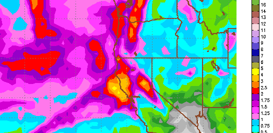
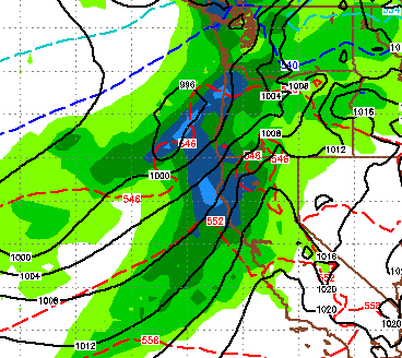
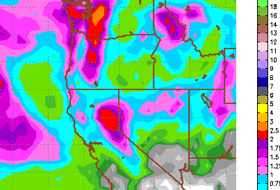
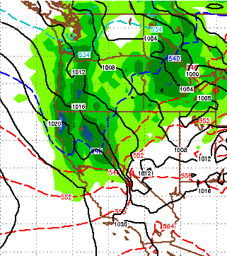
The cold front is firmly in place and we are going to get a few reinforcing shots of more cold air on Sunday and then again next Friday. We will get some light snow showers Sunday and Monday, however at this time it looks like accumulations will be minimal. Next Thursday is our next chance for some measurable snow in the Sierra as a shortwave will drop down out of the Pacific Northwest. Models in good agreement that will bring us some precip around Thursday with a cold front behind. Then as the PNA goes negative again, a stronger system will drop out of the Gulf of Alaska and should make it in to Tahoe with plenty of moisture. Of course we are still pretty far out, but models are in surprisingly good agreement and it appears that a number of factors will fall into place. This is the forecast for total precipitation next weekend: The possibility exists for some areas to pickup as much as 4 inches of liquid. With the colder air in place, snow levels for this system will be muc