Storm Delayed but Still Promising
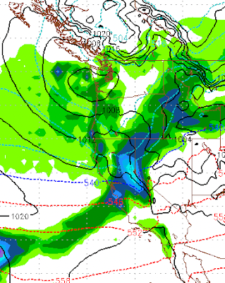
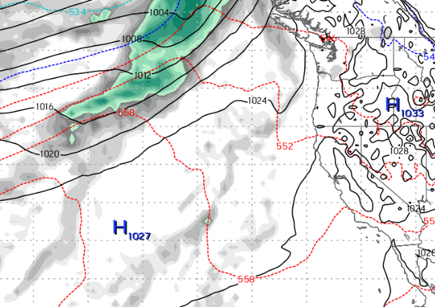
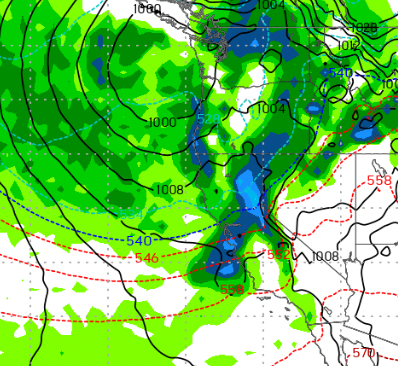
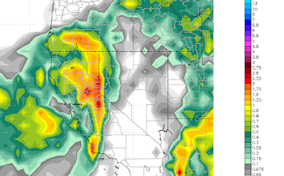
Our once promising storm set to arrive tomorrow appears to be delayed. Both the ECMWF and GFS models had forecast this as you saw from my last post. However, not all is lost. The EC weather model is still predicting a series of storms to impact our area starting next Thursday. In addition, we will have hit and miss stormy weather up until that time. Here is the forecast for Thursday, which should bring a significant moisture hit to the area. Things then get more interesting. The ECMWF model is predicting a major event starting next Thursday and lasting through the following Monday. There will be a slight pause on Friday (12/2), then the big stuff comes in. Remember this is in addition to the Thursday storm: This is the forecast for Saturday (12/3). The good folks over at the NWS would call this an AR event (atmospheric river). Formerly known as the Pineapple express. Here is a look at Sunday (12/4): These AR events bring tremendous amounts of precipitation by tapping into tropical