Next Storm on tap for Wednesday

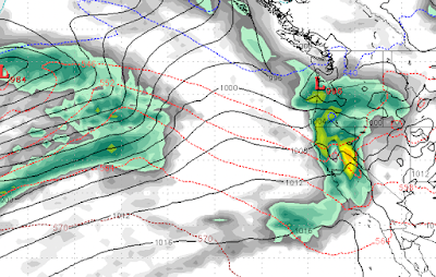
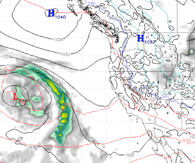
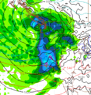
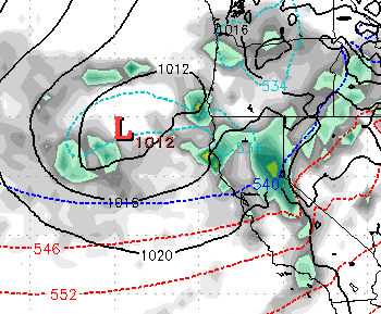
Another large, wet and warm storm is on tap starting Wednesday. This storm will be reenforced by smaller waves and will last, on and off, for nearly a week. The above graphic shows when the storm really gets cranking, Wednesday (1/4) evening. This storm will come in very warm, but snow levels will drop rapidly as a cold front comes through. Then, for the next several days, until the 9th of January, we will see all snow for all Tahoe resorts. However, by then most of the heavy moisture will have come through. Mt. Rose will again have the best conditions with its high base as this storm will challenge the base of Rose and will probably deliver at least some rain. Although most of the precip will fall in the way of snow. Here is the forecast for January 10th: This is another storm with a subtropical moisture tap, or as the NWS likes to say, AR (Atmospheric River). However this storm will start out much cooler and will deliver all snow to Slide Mountain. Some Tahoe resorts, with low bas