2 Large Storms Poised To Hit
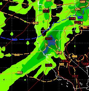
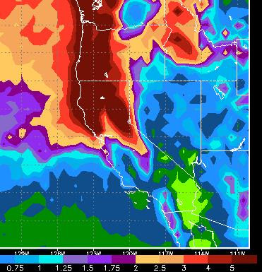
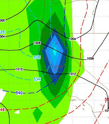
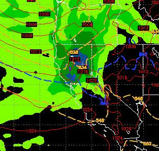
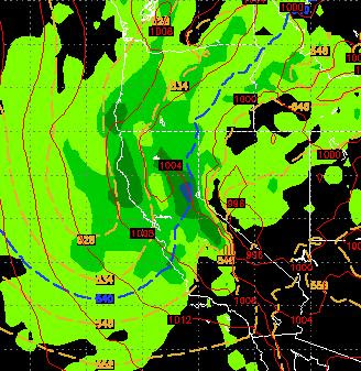
We have been discussing this for a few weeks now. Currently we are in between systems, but that will change starting tonight for the Western Sierra. Storm One Tuesday night through Wednesday The first big system will bring heavy snow to the Tahoe area. The snow levels can be variable but the local NWS is talking about 7,000 feet. This moisture is coming from the sub-tropics which means two things. 1. Lots of it. 2. Less predictable snow levels. Here is a look at the EC forecast for late Tuesday into early Wednesday: There is a large moisture tap for this wave and the Sierra will see copious amounts of snow. Most of the precip for the Carson range will fall on Wednesday, but there should be a large band of snow to dump between 12 and 18 inches ... or maybe more, at Mt. Rose Tuesday and Wednesday. Storm Two Friday/Saturday/Sunday The exact timing of this event is still up in the air. It looks like it will start Friday afternoon and wind up early Sunday morning. This storm is t