Three Storms; Then Dry
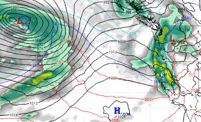
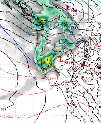
We have been talking about this storm for weeks. It will begin to effect our weather starting very late tonight and lasting through most of tomorrow. We expect snow elevations to be right at 6,500 feet for the majority of the storm, when the cold front comes through, the temps will drop along with the snow levels, but most of the precip will be long gone. We expect 8-16 inches of wet snow for the Carson Range above 7,000 feet. The peak of the storm should bring major winds that will shut down lift operations. If the lifts run at all tomorrow, it will be first thing, but that is doubtful at this time. Here is a look at the peak of the storm in the early afternoon tomorrow (1/4/2021): This storm is fast moving or we would expect much more snow. Notice the ridge of high pressure well to the south. As this storm passes through, that ridge will begin to build again. There are several other storms that we are tracking that will continue to bring varying amount of snow to Tahoe. Most of the