Huge Storm Gathers Moisture and Builds in Strength; Tahoe in the Bullseye
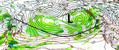
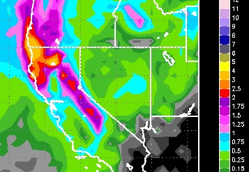
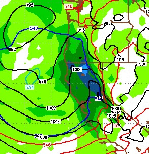
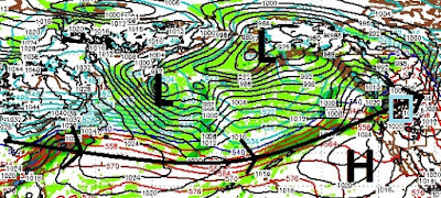
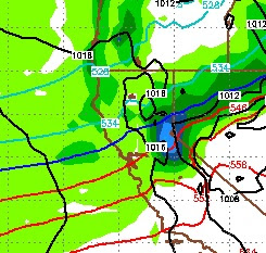
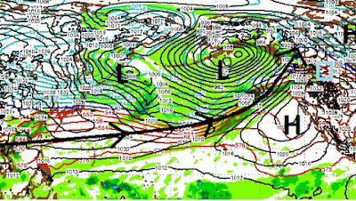
Yesterday we talked about an abrupt and sudden change to the weather pattern. Today we started to feel the leading edge of what will become a massive storm that will stretch from Japan to the Western Rockies of the USA. Here is a look at the Pacific Ocean forecast for Saturday: This storm is the gift that will keep on giving. It will stall out off the NW USA coast and send multiple waves of moisture south ... toward Tahoe. On Saturday night, through most of the day on Sunday we should see very heavy snow above 7,000 feet (I hope). There is so much moisture associated with this storm, that those snow levels could creep up to 8,000 feet to begin with. Through the morning and day on Sunday, snow levels will come down and I believe the leeward foothills (Arrow Creek, Galena Forest, etc) could see up to 6 inches of snow. Here is the latest forecast for 10:00 Saturday night: Our heaviest snow will come very early Sunday morning. We will receive heavy to moderate snow through Mo