Soaking Rains for California, Heavy Mountain Snow for the Sierra, Starts Tuesday

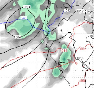
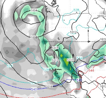
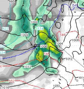
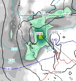
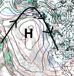
A rather large and extremely beneficial storm is expected to come in on Tuesday and stick around for 4-5 days bringing wave after wave of moisture to almost the entire state of California and heavy mountain snow to the Sierra. Our current system is trying hard to produce. The first wave went by us to the west and north and the second wave is missing us to the south. However, I think the Carson Range could pick up around 3-6 (at most) inches of snow tonight and early tomorrow morning. Before we get into the forecast, if you did not see this earlier, we were sent a video of Ski Patrol doing avalanche control in the Chutes of Mt. Rose last week. I have been asked to post it again, it is pretty amazing. Mt. Rose Chutes Avalanche Control We have a giant trough of Low Pressure headed our way. Although the models are not in total agreement, we believe here at TWB that this will be a major winter storm for the Sierra and Carson Range. Here are the details: Tuesday at Noon (3/13)