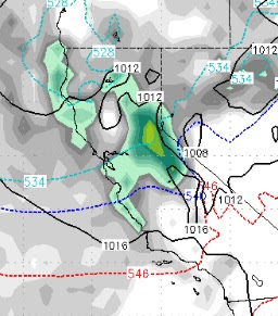
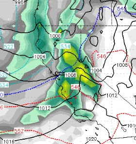
The Last Storm in the Current Cycle is Knocking at the Door
The current storm cycle has lasted nearly a month with several strong storms dumping lots of snow throughout the Sierra and Carson Range. That cycle is coming to an end, but not until we get pounded by one more large storm. We have been talking about this storm for about 10 days now and it is not going to disappoint. There will be some shadowing for the Carson Range but we still expect snow measured in feet starting tomorrow and ending early Friday with a 2nd wave on tap for Saturday. Snow levels could approach 8,000 feet when this thing really gets going. Initially however, we are looking at 7,000-7,500 feet. When the heavy moisture comes in the snow levels will rise. How high? Our best guess is above 8,000 feet for a short period of time until a cold front comes in and drops snow levels all the way down to 5,000 feet. For the most part, this will be all snow for Mt. Rose. There is a better than 50/50 chance that snow levels never make it to 8,000 feet. Approaching Storm (Tomor