Major Weather Pattern Change to Arrive Around the 21st
We alluded to this pattern change in our last post. The models are converging and even the NOAA long range forecast is calling for a likely stormy pattern heading to the entire West Coast starting on the 21st and lasting into March.
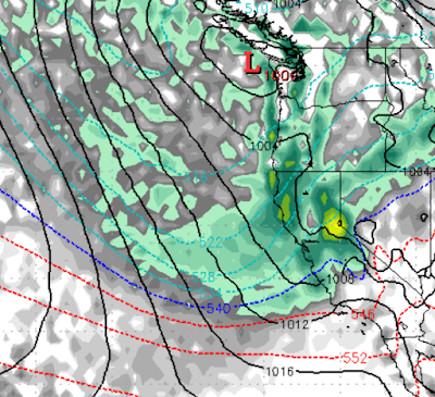
Here is a look at the forecast for the 21st. This is the first in a series of storms as the polar ridge that has brought the Central and Eastern US into the deep freeze starts to break up.
We know this is a ways out, but our confidence is very high for a number of reasons. Mostly, many of the weather predictors (AO, MJO, etc) are all pointing toward this event. In addition, the ECMWF Long Range is now forecasting this.
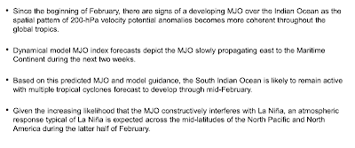
This from NOAA, the last bullet point is most relevant to us:
So enjoy the next 10 days of high pressure as things are going to change rather dramatically.
March Miracle? Maybe!
Stay Tuned ...