Will February Roar In Like a Lion?
We are now in a more typical El Nino pattern. As small waves of precip will continue through most of this week.
We are looking for storms to continue to move further south, be strong enough to pull up sub-tropical moisture and cool enough to produce snow. Unfortunately, that is a rare combination with El Nino winters. Mostly, we can expect warmer temperatures as the storms approach.
But, 2 out of 3 aint bad, right? Looking ahead we are seeing the possibility of a decent sized storm to develop toward the end of this month or the beginning of next month.
Here is the forecast for the 31st of January. Remarkably, the long term models seem to mostly be in agreement about this event. Generally, that is a fairly reliable predictor.

The above is the European model, here is the Canadian:

Eerily similar. Both these models have this coming in as a very warm and slow moving storm. I believe we will have all snow up at Mt. Rose and snow levels will mostly hover around 7,000 for the majority of this weather event.
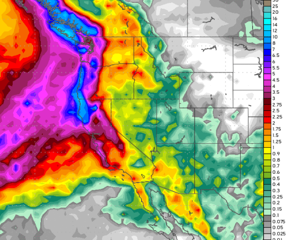
As we begin to catch up to our seasonal precipitation averages, here is the precip outlook for the next 10 days:
If you are thinking we got this much snow in 24 hours last year, well you are correct. But this is not last year and El Nino brings a whole new equation. We still expect above average snowfall for the season despite the slow start. Conditions are getting better up there in the Sierra.
Stay Tuned ...