Prepare For Major Changes
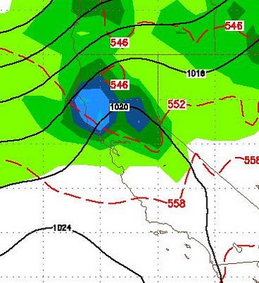
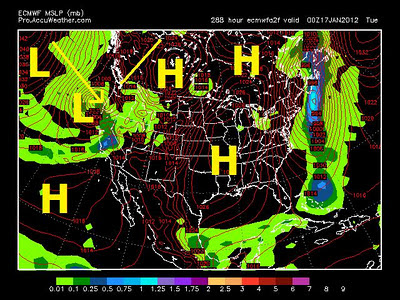
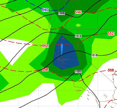
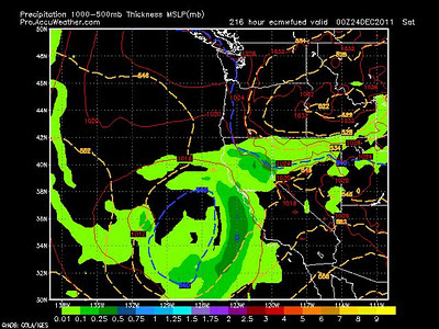
Starting today, prepare for major changes in our weather pattern. Tonight a cold front will be coming through the area. It will snow some in the Sierra, but probably not much. It will bring very cold air that will plunge low temperatures on Monday night into the single digits. This is just the first of a 4 part wave to hit the area. When all is said and done, expect 5-10 inches of liquid precip in the Sierra. The 2nd wave comes through on Thursday. There are some concerns about snow levels with this system. Right now the NWS is predicting the majority of the precip will be rain under 9,000 feet, especially just south of here. That could make it down to 8,000 feet and we will monitor as this 2nd wave approaches. Here is what GFS thinks for Thursday late morning: Late Thursday Morning 1/19 The third and biggest wave is set to come in Friday afternoon and last through Saturday. This system also is raising some concerns about snow levels. Here is the GFS look for Late Friday: L