Snowy Pattern Continues
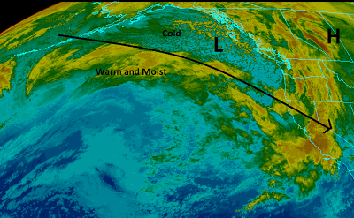
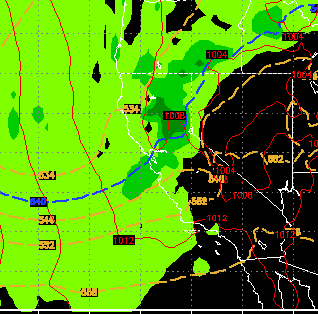
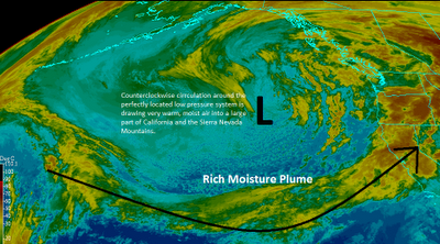
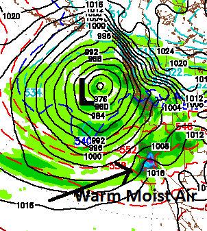
Not much has changed since I last blogged. I will try to pinpoint the powder days that are upcoming, there should be many. First of all we are moving deeper into a very cold snowy pattern. I have charted it out. Basically, we have a blocking ridge of high pressure that is dropping Arctic Cold into Central Canada (See post on Arctic Oscillation). That is forcing a large cold air mass down through our area that is tapping into a very wet moisture tail. Remember, you can click on any image and get a much bigger picture. This afternoon and this evening we will see more snow coming to the Sierra. It will tapper off later tonight and leave between 2-6 inches in the Sierra and Carson Range. Probably the lower amount in the Carson Range (Mt. Rose). Tomorrow should be great, just like today. Perhaps a bit more pow. Now the fun gets started. It looks like near constant moderate snowfall in the Sierra and Carson Ranges starting Sunday night and lasting until Tuesday afternoon. I look for