Fast Moving Storm Will Bring Wind, Cold and Snow
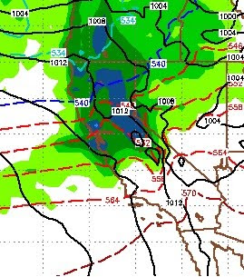
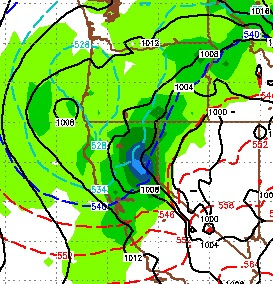
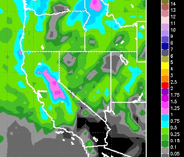
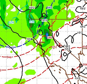
This storm that is knocking on the door will be here and gone before you know it. However, there is some moisture associated with this storm that could see snowfall rates around 2 inches per hour for several hours, especially north and west of Lake Tahoe near the Sierra Crest. Shadowing is strong, so precip amounts will be much less for the Carson Range. We could be talking 2 feet for the western crest and about 6-8 inches for the Northern Carson Range. The good news on several model runs today is it appears next week could bring us a series of shortwave events ending with a warm, wet storm around the 10th of the month. This is a much better solution that what we have been looking at for the last week, and perhaps the long range will pick up on a very fluid weather pattern. One thing is for sure, the Pacific Northwest is going to be exceptionally wet and rainy. Some models are showing 2 feet of liquid precipitation for Washington State over the next 10 days. We are hoping that the pa