We're Not Done Yet; Next Two Storms Look Warm
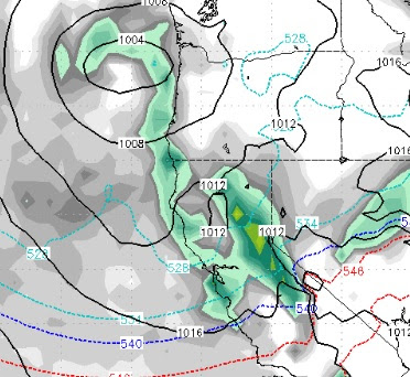
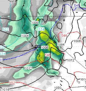
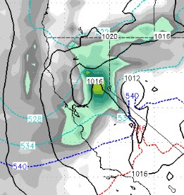
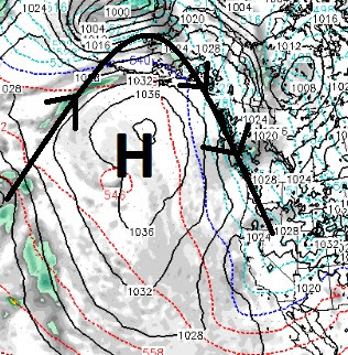
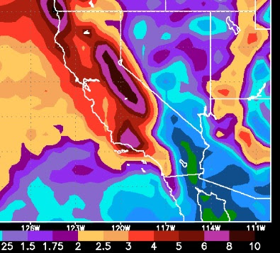
We are currently in the lull that we talked about last post. This will not last long as this powerful storm begins to crank up again by mid to late afternoon: The storm is forecast to finally clear out by late Saturday afternoon but not before dumping 4-8 feet of snow throughout the Sierra and Carson range with similar amounts in the Central Sierra around Mammoth. This storm actually came in warmer than we expected but snow levels hovered around 5,200 feet at the their highest, which is a far cry from a typical large Sierra dump. Then next two storms are coming in much warmer and snow levels could start pushing the 8,000 foot mark again. The first of the two storms now looks to be heading further north than we expected in our last post. That will deliver the Tahoe area just a glancing blow. Notice the red lines, that is warmer air which is completely different than what we have been experiencing over the last few weeks. A third storm is now appearing on the horizon. Alt