Major Pattern Change Starts Now
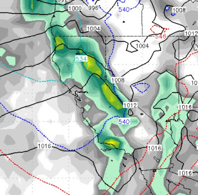
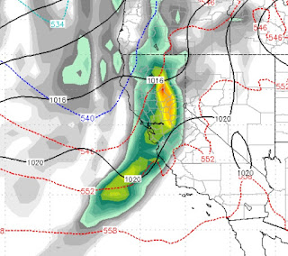
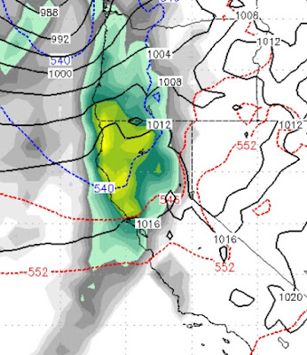
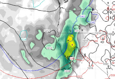
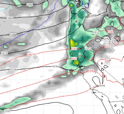
A series of storms should move through the Tahoe area and bring a big dose of winter for at least the next 10 days. It would be impossible to tell you when all the snow starts and stops, so we will concentrate on the highlights of the 4 storms that are stacked up and poised to hit our area. These storms are coming from the west, which should be a better trajectory for climbing over the crest and pounding the Carson Range as well. Saturday January 5th @ 10:00 pm Sunday January 6th @ 4:00 pm Wednesday January 9th @ 4:00 am Friday January 11th @ 10:00 pm Sunday January 13th @ 10:00 am The pattern does appear to continue past the middle of January. Here is a look at the forecast liquid precip for the next 10 days: As we said in our last post, which predicted this major pattern change over a week ago, the Carson Range is forecast to pick up anywhere from 4-8 inches of liquid precip which in a worst case scenario, should be 4 feet of snow in the next 10 days. I