Cooler Temps, Weak System then More Dry Weather; Possible Major Pattern Change for Early December
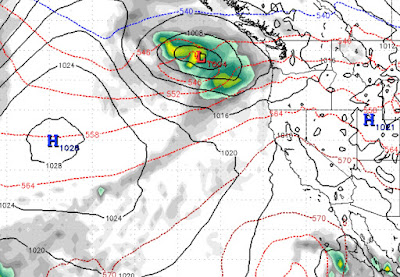
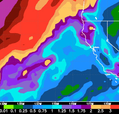
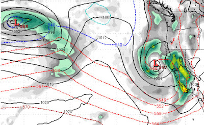
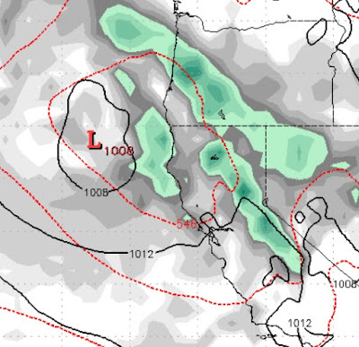
We have a very weak and dry system dropping down off the NW Coast of the US. It will pick up moisture from another weak system that will move in over Southern California. The northern system will drop temperatures, significantly. There is a slight chance of very light snow for the leeward Sierra. The major culprit for our dry weather, is that high pressure system off the west coast. That system has moved out a bit and allowed a nice alleyway for that Low to the north to drop down. But the High is very large and will force that low inland, way too soon. It will make it's way down to our area, but has no moisture tap to speak of. Our moisture will come in from the east so this will be an Eastern Sierra event. It is getting what little moisture it can from another Low Pressure system from the south: This weak system is really nothing but another cold slider, which can be great with a 10 foot base, but this will do little if any good. Mt. Rose could pick up a couple inches of