Trapped Inside a High Pressure Dome
Currently we have two ridges of high pressure that are dominating our weather.
Any and all storms are being shoved north. In addition, our air is so stagnant that we are under a strong temperature inversion. What is a temperature inversion? This occurs when there is little or no wind, almost always during the winter. The warm air rises and the cold air descends. That cold air is trapped and has nowhere to go. Currently it is 20+ degrees warmer in the Sierra than the leeward valleys.
If you read our last post, fear not, change is coming. In fact it is beginning as we speak. A larger storm will drop out of the Gulf of Alaska and begin to shove our ridge out. However, what you can tell by the strength of this inversion, the high pressure dome is quite strong. It will take some time. Here is the forecast for late tomorrow, we are already seeing some movement.

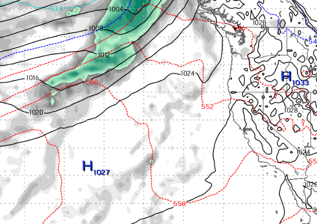
By this weekend, our once proud ridge will be all but gone. That will open the storm door into Tahoe. Here is a look at early Saturday (11/26).

Finally by late Sunday (11/27) storms will be free to come into our area:

This storm, which will enter our area late on Sunday could last for several days and leave behind several feet of much needed snow. Here is a look at Tuesday (11/29)

Notice our ridge of high pressure has been shoved way out in the Pacific. By the time this thing passes, many areas of the Sierra will have an additional 6+ feet of snow. Here is the liquid precip forecast for the event:

If things go according to plan, Slide Mountain could see 2-4 feet of snow, which should open a significant amount of terrain.
Stay Tuned ...