Weather to Remain Cool and Stormy For Next Couple of Weeks (At Least)
Winters tight grip on the Tahoe area will continue into the foreseeable future. We have a series of storms and reenforcing cold fronts that are stacked up and waiting to continue the onslaught on the Sierra and Tahoe especially.
Tuesday 3/28
This is a cooler storm, will likely produce snow above 6,000 feet but those levels could drop as well. For now looks like rain for the valley. This storm will send waves at us following the main front for a few days.
Monday 4/3

Wednesday (4/5)

If this holds together, it will usher in a very stormy pattern.
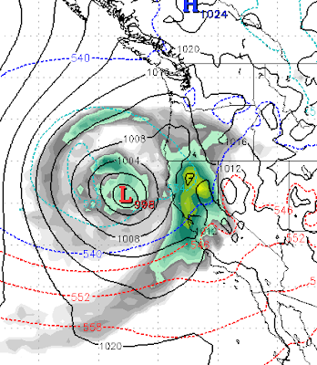
Saturday 4/8

Could this be a late season AR event? It is two weeks out, so no guarantee, but anything is possible this year!
Finally, here is the precip forecast for the next couple of weeks. Amazingly, the Central Sierra around Mammoth is looking at another 10-12 feet of snow. The western crest should see 6-8 feet while the Carson range is in the 3-5 foot range.

Stay Tuned ...