Storm Machine to Crank Up Next Week; Winter Outlook

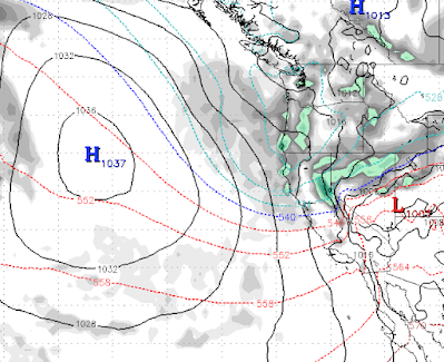
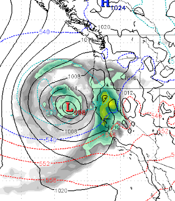
Storm Watch Today's storm is nothing but a small teaser for what looks to be a major winter storm in about 8-9 days. We are tracking a major storm that both the EC and GFS weather models are in very good agreement. Here is a look at the forecast for the 15th of November: If this storm holds together it will begin somewhere late on the 13th and could bring copious amounts of precip to the Sierra and Carson Ranges of Lake Tahoe. We believe this will be all snow for Mt. Rose as snow levels will start high but quickly come down. The following is the forecasted precip for the next 10 days. Needless to say, if this hits as all snow, Mt. Rose should be able to open quite a bit of terrain as we are talking about upwards of 4 feet. Let's hope it does hold together as we are seeing a ridge in the jet over our area moving forward, not unexpected this time of year. Season Watch We have been very lucky the last several years with our season snowfall predictions. We were the only site that p...