Posts

Smoke Report

Image
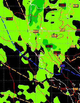
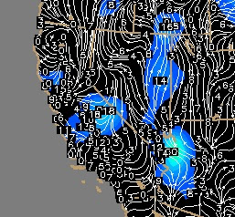
I have been asked by some of my loyal readers to give a smoke report for the Reno/Tahoe/Carson area. It seems the local weather people are unwilling to commit to anything. Since I do not get paid to do this, I will tell  you what the models and wind forecasts are telling me. Let's hope they are wrong. We have been in a straight southerly flow. That means our winds are straight out of the south. We are due north of the Rim/Yosemite fire and the wind has made a beeline to our area (DA!). I am seeing a change over that should result in a westerly flow, however, this will be short lived. This could improve conditions slightly for the next 12 hours or so. However we still have a very stubborn ridge of high pressure that does not look like it will move until Labor Day ... sorry. The GFS model has a low pressure system coming into our area. Buyer beware: the more reliable EC model has that system staying further north. In any event, it should be enough to push the smoke out by early

Ma Nature Throws Another Curve

Image
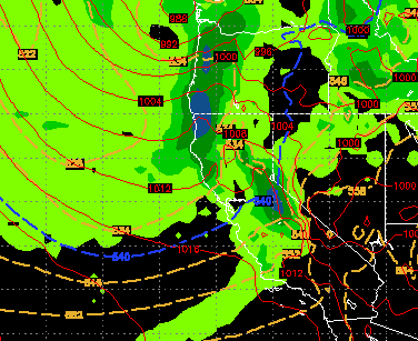
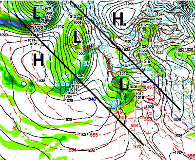
This has been a pretty amazing season. We started with what looked like a moderate El Nino which lead to an epic start of the season. Then the spigots were turned off, literally. Storms kept forming and approaching and dying. The weather turned warm and calm for much of the spring. Then summer showed up and the temps dropped off the table. So what gives? The simple answer is that nature is unpredictable. Even this time of year. Many years we struggle to get into our summer weather pattern. What makes this year different is the mild spring temperatures. Most readers thought Ma Nature was done until next fall. Not so fast. We have a surprisingly strong storm just of the Northern California Coast that has some very wet and cool air associated with it. The actual low is just off the Southern BC coast. The cold front is moving into our area today and will bring rain, clouds, wind and cool temperatures for the next couple of days. Below is a map of current conditions and trends. The co

No April Fools, Storm Track is Heading Our Way

Image
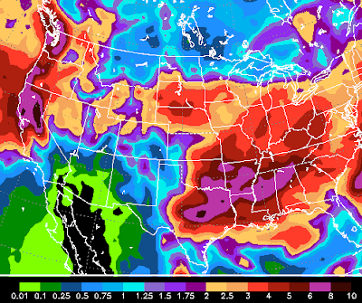
The Jet Stream is going to set up right over our area and that will usher in a series of storms that could make April a very storm month. Currently, the more reliable EC weather model is forecasting 8-10 inches of liquid precip for the Carson Range starting on April 1st and lasting 2-3 weeks. Here is the latest monthly control view for total precip ending on April 20th: As can clearly be seen, West of Tahoe is in the 10+ inch range and the Carson range is in the 8-10 inch range. Remember this is liquid precip. We could be looking at a major weather event for the higher elevations of the Sierra and Carson Range. The fun should begin around the 1st of April. Here is a look at the forecast, notice the storm is off the coast and the leading edge is pulling in precip for the entire state of California. The only downside to this pattern is snow levels will be very high. How high? Right now it looks like 8,000 feet and up. Of course that could change as could the entire weather pa

Storms Weaken and Head North

Image
We are still looking at a precip event for Wednesday and Wednesday night but not nearly what I had hoped for last week. These storms are moving in from the west and shifting north before they come ashore. Although this storm has a good moisture tap, it just moves too far north too fast. Here is a look at midday on Wednesday: Here is the precip total forecast: As you can see, the models have backed off a major event. We are looking in the 6-12 inch range for the Sierra North and West of Tahoe and 4-8 inches for the Carson Range with more to the north of the lake. Look for pretty high winds to accompany this storm as well, especially Wednesday afternoon into Wednesday evening. Looking ahead, the more dependable European model is forecasting 6-8 inches of liquid precip within the next 30 days with no focus on a major storm as of yet. I will keep any eye out and report accordingly. Stay Tuned ...

Nice Weather to Gradually Wind Down, Storms on Tap for 3/21 - 3/26

Image
Our very mild weather will slowly cool each day until next Wednesday/Thursday. Then things get really interesting. A very large and impressive storm is headed our way and could bring as much as 4 inches of liquid precip to the Western Crest of Lake Tahoe. It will tap into very warm moist air and elevations on this one could be a little tricky. For Mt. Rose, expect all snow. Preliminary indications, however, are 7,000-7,500 feet. Here is a look at next Thursday, March 21st: This storm comes in from the west and moves North as it reaches land. This could be a bullseye on Tahoe and could bring a major weather event. Being a week off, we will have to wait and see, but this comes from the much more reliable European Model (ECMWF). Here is a look at the precip forecast for this storm, pretty impressive for late March: This storm is going to stick around for a while and should send several waves of precip our way. It will finally exit the scene as another storm pushes it out. H

Swing and a Miss

Image
As is often the case, when the weather models are in wild disagreement, our hopeful forecasts whiff. Our potential for a foot or more of snow last week, faded into the weeds as both storms weakened significantly and only left behind 2-4 inches. Our next hope was for the first week in March. My good friend, Sven, over at Unofficial Mt. Rose  sent me an interesting tidbit from NOAA. That tidbit talks about conditions ripening in that first week of March. That sent me back to the models and lo and behold, the two most accurate models are now focusing on what looks like a decent snow event for around the 6th or 7th of March. In addition, both models are looking for another event about a week later, March 14th. First let's take a look at the 3/6 event; I have posted 3 charts below. In chart one, around the beginning of March, we can clearly see that conditions are finally ripening. We have our blocking ridges of high pressure right where they need to be and a few decent sized storms

Wash Your Car

Image
Beautiful weather for the weekend will turn into a series of storms heading our way for next week. The pattern change will begin on Tuesday and last through the weekend, at least. These systems will bring in much colder air but the models are in stark disagreement with the amount of moisture headed for the Sierra. We will focus on the more consistent EC model. Below are a series of forecasts for what I would call  chances for moderate snow in the Sierra on Tuesday night, Friday and Saturday. Tuesday Night Friday (2-22) Saturday (2-23) These storms together could bring as much as 1-2 feet of snow to the Sierra and Carson range. They will also bring much cooler temps and much windier conditions. Remember, the EC model is the most aggressive. The GFS, which has been the least reliable model for a couple of years now, is predicting much less precip. Finally I wanted to show you why a chance exists for these conditions and storms to continue into the first week of March