As Major Change to Weather Pattern Takes Hold, Expect Large Storms Over Next Several Weeks
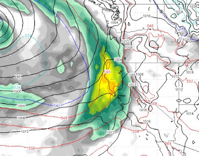
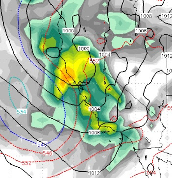
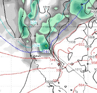
The change we talked about for the last 3 weeks is starting to take hold. The first major storm is knocking on the door. We will keep our forecasts the same. However, this storm is really pulling up very warm, sub-tropical air and snow levels will start out around or even above 8,000 feet. By the time it is all said and done, however, we still believe the Carson Range and Mt. Rose in particular will pick up 18-36 of very wet snow. Warm air will then come in and take over before two very large storms will produce more major weather events, starting around the 15th. We will focus on the long range forecast. This current storm is being covered by the NWS and other outlets, we like to focus on what is coming down the road. Remember, we forecast 10+ inches of liquid for the month of January. Right now that forecast looks pretty good. Here is a look a the forecast for mid-day on January 15th: This is another very similar storm to what we are getting now. I think the possibility does