Storm Update and Future Forecast
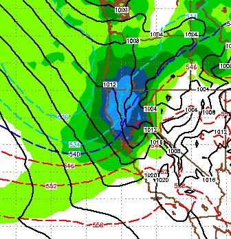
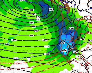
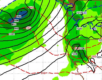
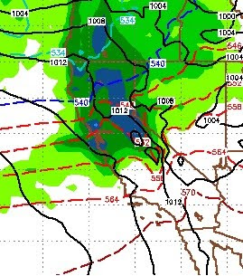
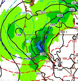
A very cold storm is knocking on the door. It will bring high winds to the party as well. In fact when you wake up tomorrow morning, there is a very good chance the lifts at Mt. Rose will be closed as slide mountain could be seeing Category 4 Hurricane winds (130 mph). Right now, it looks like the snowfall will be intense but short lived. Here is a look at the forecast for tomorrow starting at around noon and lasting into the evening. There will be some shadowing effect, which will slightly limit the amount of snow in the Carson Range: This system has a very adequate moisture tap, however there are no inland systems to act as a blocking force so it will quickly move through our area. By around 6:00 in the evening here is what it should look like: Finally, here is what the EC model see's in the way of total precip for this storm: Snow levels will start at around 6,000 feet. This will be all snow for all of Tahoe. The western shore ski areas will get the most snow o