Storms to Continue for Another Week, Then Big Warm Up
The current storm cycle will continue on and off (mostly on), through next Saturday (3/4), then it appears our pattern will change to dry and possibly warm. Both our favorite models are predicting a huge warm up starting around the 8th of March. We could actually go from lows in the single digits to highs in the 70's.
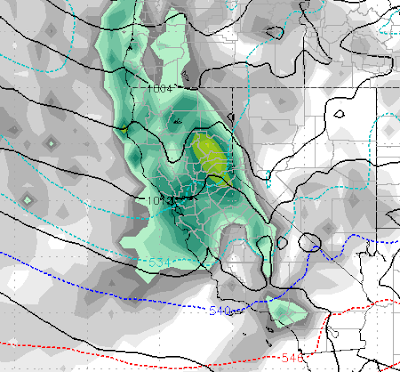
First, we have a series of storms that are going to continue for the next week. Here is a look at what we are seeing:
Monday 2/27 @ 4:00 pm
Wednesday 3/1 @ 4am
Saturday 3/4 @6:00pm
So the pattern stays active until the 5th of March as the storms slowly move away and high pressure begins to take over.
Take a look at the forecast for the 9th of March:
That is some very warm air all the way up into BC. That trough of Low Pressure is going to bring up some sub-tropical air. Of course with the huge snowpack, that could cause a very quick melt off, so we will have to keep an eye on that.
Here is the forecasted precip totals for the next week:
Looks like an additional 2-4 feet of snow for Mt. Rose, while Mammoth is looking at an additional 4-6 feet to go along with the 4 feet they picked up already and the nearly 40 feet they have received this winter.
Stay Tuned ...


