Major Pattern Shift in About a Week
The current pattern which is marked by weak cold fronts dropping down and leaving us with a few inches of snow and very cold weather is going to change back to a very stormy pattern in about a week.
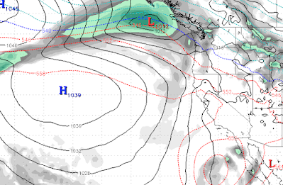
The first step is a storm to our north (2/21) that will knock our ridge of high pressure considerably further west. That will open the storm door.
Next, a series of storms will come into our area getting progressively stronger, notice the ridge way out at sea:
Wednesday (2/22)
Friday (2/24)
Monday (2/27)
Wednesday (3/1)
This pattern looks similar to late December and if it holds, March comes in like a lion. Here is the forecast total liquid precip for the week starting February 21st:
If you are wondering if you are reading that correctly, yes it says 10-12 inches of liquid precip which could translate into 8-15 feet of snow for most of Tahoe.
As has been the case this winter, these will be cold storms and as of now it looks like this will be all snow for all Tahoe Resorts and quite a bit of snow for the leeward foothills and a rain/snow mix for the leeward valleys.
Stay Tuned ...


