Cold Storms Begin Their March Through Tahoe
Yesterday's cold front was just the beginning of a series of storms poised to hit the Tahoe Area for around the next week. We are seeing a rather significant Rain Shadow associated with these storms. Put another way, the Western Sierra will receive much more snow than the Eastern Sierra around Tahoe. The Central Sierra will be picking up a ton of moisture which will be all snow.
For Tahoe, the best chance for significant snows come early Friday (2/24) and the following Monday (2/27). Again we are seeing a Sierra Shadowing effect for the eastern Sierra.
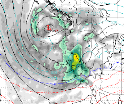
Here is a look at late Monday:
We expect snow on and off through Wednesday (3/1).
Here is a look at the precip forecast. Notice the difference between the Western and Eastern Sierra around Lake Tahoe:

By the time this storm cycle ends, this will still be a significant precip event, just more so for the Central Sierra. Obviously, this brings very beneficial rains for most of California as their reservoirs continue to fill up.
This will be some of the coldest weather we have seen in what has already been a very cold winter. We do not see temperatures rebounding back to average any time soon. I hope you all enjoyed last Tuesday!
Stay Tuned ...