This is not Over Yet, Another System for Late Friday

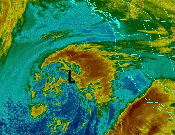
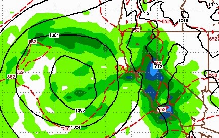
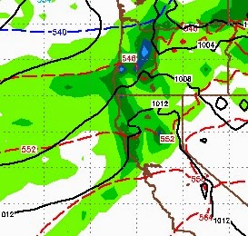
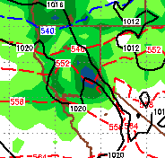
With better than expected snowfall totals from yesterday, we are looking at the upper range of our earlier 18-36 inch forecast for the Carson Range. Mt. Rose has been the big winner thus far with all snow ( Unofficial Rose ). I expect heavy snow today and tonight, followed by a brief lull and then another storm comes in for Friday. Here is the forecast for 4:00 this afternoon as the storm continues to pound our area: I expect the snow to continue until about 3:00 Thursday morning and then expect periods of snow as the front passes through. Snow levels will remain in the 7000-7500 foot range. I expect another foot or possibly more for the Carson range above 7,500 by Thursday night. Another system moves in for Friday. The models have that system coming in from the north and I do expect it to make it down to our area and bring even more snow, 4-8 inches by early Saturday morning. Here is a look at the forecast for 10:00 Friday night: Above 10,000 feet in the Carson