Posts

2016/2017 Tahoe Winter Weather Outlook

Image
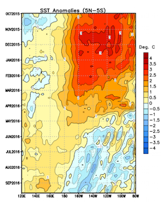
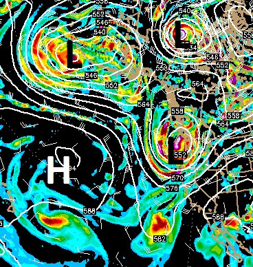
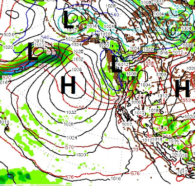
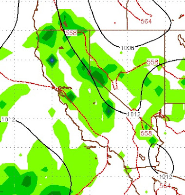
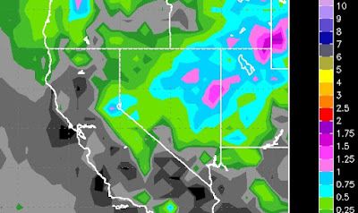
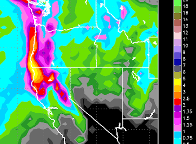
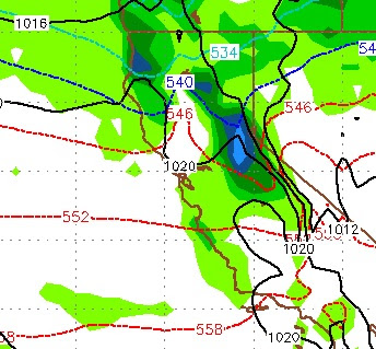
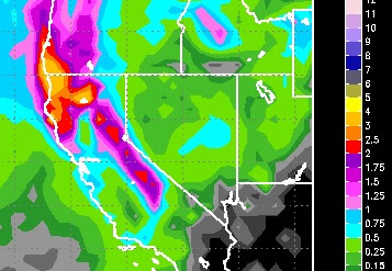
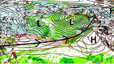
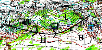
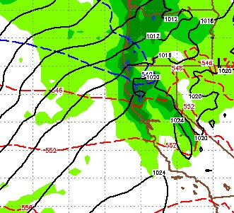
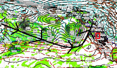
What better time to predict what type of winter we are going to have than when our first storm of the season is knocking at the door. In fact, a series of storms will be dropping out of the Gulf of AK and into our area. Although none of these storms are very impressive, they will change our weather with high temps 20-30 degrees cooler than the last week. This pattern will continue for about 7-10 days and then perhaps we will see some 70's again. The above chart shows that we went from a strong El Nino to now a neutral ENSO. Actually, Equatorial sea surface temps are now ranging below average and if we do not slip into a La Nina this winter, we have an excellent chance next winter. Quite frankly I do not believe much in predicting Tahoe winters based on the El Nino Southern Oscillation (ENSO). As we saw last year, this is not a terribly reliable measuring stick. In fact, our snowiest winter in history occurred during a strong to moderate La Nina. Despite conventional wisdom s

Very Active Pacific Weather Pattern

Image
A couple of unusually strong storms are headed for the Sierra that will bring upper elevation snow, high winds and cooler temperatures. The first storm will come in late Sunday afternoon. Storms this time of year do not pack much moisture. I doubt any moisture associated with Sunday's storm will make it over the Carson range. But the cold air and wind certainly will. Here is a 500mb look at the Pacific ocean. First thing to notice, our ridge of high pressure has been pushed out to sea again. Second thing to notice, the storm track is very active, with storms somewhat stacked up. If this were late December, it would be quite impressive. Again, I do not see copious amounts of precip, but I do see much cooler and more windy weather for Tahoe and the Sierra through at least next Saturday (and Reno/Carson too). Paul Hunnington, the top researcher at TWB and maybe the top researcher anywhere, makes this observation: What is happening is the North Atlantic Oscillation is lock

Stormy Weather Pattern to Return

Image
A low pressure system will squeeze our persistent ridge of high pressure to the west and effect our weather for at least the next week and probably longer. The ridge of high pressure which can dominate our weather will be moved out of the picture allowing storms to come into our area from both the East and the West. The following two images show the current conditions and conditions in about 4 days. Notice the high pressure ridge getting moved to the west: This will usher in a change to our weather that will last into the foreseeable future. Snow levels for these storms will vary from 8,000 to 10,000 feet. The blocking ridge of high pressure will allow moisture to be pulled into our area from the Gulf of Mexico ... again. Just goes to show, Mother Nature will do as she damn well pleases. Stay Tuned ...

Wet Weather to Continue Through Weekend

Image
If you read our last post, then you were warned. Heavy, consistent rain has been falling for a couple of days now. This will continue through the weekend to some degree. Probably not as heavy or as consistent as what we have seen of the last 36 hours. High pressure over New Mexico and Arizona is blocking a Low Pressure system located just off the Southern California coast. This is causing ample moisture to work its way back east into our area. Ironically, as this moisture hits the Carson range, it is somewhat shadowed. Very little of it is making it over the Sierra and into the California valleys where it is needed most. Northern Nevada had broken out of the drought a long time ago. I believe that the same holds true for Northern California but I will let the politicians, who know nothing,  argue about that in the context of man-made Global Warming. Here is a look at our current conditions. Notice the Low Pressure system sending moisture north and into our area and the Northern Roc

Very Wet Week Ahead

The Tahoe area and Leeward Valleys of Northern Nevada are in for a very rainy couple of weeks, at least. Several factors are involved, including off short troughs in the Pacific NW and inland troughs both southeast and northeast of us. Add a blocking ridge and we are going to see moisture coming from all directions. Our top researcher, Paul H, had this to say about what to expect long term: The wet pattern appears to continue till at least May 11 and is now indeed looking to be an interesting end to this interesting Super El Nino. I want to say I see a break in the Sierras from this wet cool weather but I'm not and it must be similar to what the dark ages were like in Europe- the summer solstice with frost and sleat. To be honest I believe the "sleep of the sun" (solar minimum) is playing a role in all this from the severe weird drought to extremely warm oceans to now this bizarre cool wet pattern I'm seeing continue into June. The Law of Thermodynamics and heat d

Large, Cold Storm will Usher in a Return to Winter

Image
There is a large storm that will hit the Tahoe area and bring back memories of December for at least 36 hours. Looking ahead, we are going to be in a very stormy pattern with below average temperatures through next week ... at least. First things first, starting Thursday night a large storm (for this time of year) will begin to approach Tahoe and bring with it very gusty winds. The brunt of the storm will hit late Friday afternoon. Here is the forecast for around 4:00 no Friday: As with many storms this time of year, this storm will work its way south down the Sierra and bring at least double the precip to the Sierra compared with the Carson Range. But fear not, a series of short wave sliders will continue to bring in waves of cool air. These storms tend to work their way down the Carson Range and bring more precip to the Eastern Sierra and Carson Range. They also bring plenty of cold air as our dominant weather pattern will be from the north. The storm for Friday/Saturday w

Strong Cold Front for Wednesday, Thursday. Much Warmer this Weekend

Image
A strong moisture starved low pressure system will fall out of the north and put the chill in our weather starting late tomorrow. This storm packs more cold air than anything else. It will bring little if any precip to the Carson Range (1-3 inches), more is possible for the Western Crest (3-6 inches). From a wind standpoint, this storm is relatively tame. I suspect the lifts at Rose will spin most of the day tomorrow and all day on Thursday. Although the temps will be significantly colder. Here is a look as the storm rapidly approaches out of the north very late tomorrow night: This storm will dive south after making landfall and break up for the most part. Most of the strong winds will be late Wednesday and very early on Thursday. Winds will die most of the day on Thursday but will be out of the north and cold! High pressure takes over starting Friday and by Sunday we will be well above average, perhaps mid-70's for the leeward valleys. This high pressure system will stic

Don't Count El Nino Out Yet as Winter is Coming Back

Image
Winter is going to make a comeback over the next 7-12 days at least. A small storm is coming in from the south and will actually deliver some much needed rainfall for Southern California. Although, I do not see a major rain event, they will take what they can get. That southern storm will work its way north into the Tahoe area and produce rain and upper elevation snow. Then, a larger storm will drop down out of the north and remind you of January around the middle of next week. This storm will bring beneficial rains to Northern California and snow to the Western Crest of the Sierra. Interestingly enough, the models are not in agreement here. The GFS is more bullish on both storms producing precip for California. The EC is has lighter amounts and later timing, but believes the Carson Range and the leeward valleys will join in on the party. I usually side with the EC as it has been the more reliable model. Let's start with the GFS for late on Friday: This storm is centered

Cold Slider Comes Tonight

Image
The weather models are moving our slider slightly further west on its trajectory to Tahoe. That could bode well for more moisture for the storm to work with. I was not bullish on this storm yesterday. Today I am a little more optimistic. The storm comes in tonight and will stick around through Tuesday. The impact of this storm will be felt on the eastern side of the Sierra Crest and the Carson Range. Perhaps the biggest impact is the cold front that is coming with this storm. Temperatures will be much colder through most of the week. Nobody is trying to predict snowfall amounts. I am going with 6-18 inches for the Carson Range by Tuesday night. Slightly more for the eastern side of the Sierra Crest. Here is a look at the Precip forecast by the EC weather model: Dry weather follows through the week. Stay Tuned ...

Storm Update

Image
The timing has changed since our last post. We are now looking at a minor event for Tahoe late on Monday night. I believe there is a possibility for 4-8 inches of snow at Rose. Northern California will pick up another nice dose of rain. However, this system is small and weak. Looking ahead, our persistent ridge if high pressure moves in and begins to dominate our weather for at least the next week. Here is a look at the precip forecast for this next storm: As you can clearly see, some beneficial rains for Northern California.The Carson range could get up to an inch of the liquid precip, which could translate into around 8 inches of snow. It is going to get windy as the storm moves through, but I think the lifts will spin Monday morning and Tuesday morning as the timing of the storm and winds appears to be late Monday into very early on Tuesday. Winds will pick up all day Monday as the storm approaches and then die down as the cold front moves through. Stay Tuned ...

Small Storm for late Sunday, Dry and Before and After

Image
The EC and GFS weather models have a small storm on tap for late Sunday. This will usher in cooler air. I doubt there will be any effect on the Carson Range as the later we get in the year, the weaker the storms become. The EC is more bullish on this storm. Here is a look at the forecast for late Sunday afternoon: If this holds together, we could get come spill over the crest, but I am not pinning my hopes on it. After this storm moves through, high pressure will dominate for at least the next week. Stay Tuned...

Storm Update

Image
As storms continue to move into Northern California, they slide south, not generating enough energy to make it over the Sierra. Our two best chances for snow come Sunday morning around 10:00 am and then very late on Sunday night through Monday morning. I would say the storm tomorrow morning has the best trajectory to make it over the Sierra and have an impact on the Carson Range. Just for comparison sake, the GFS does not see any wave coming late Sunday night into Monday, while the ECMWF model has the following for Monday at around 4:00am pst: When we have this divergence in the models what usually happens is something in between. In that case look for light snow Sunday night through the morning on Monday. All models have things drying out for at least the next 7 days and then we may be entering another storm cycle. Stay Tuned ...

6 Days of Storms Start Today

Image
A series of storms will move into California. Beneficial rains will make it further south. This time, the Central Sierra appears to be in the Bullseye. That is until Monday. Before we get into that, these storms are moving out of the north. For the most part they will stay on the other side of the Sierra as they move south through California. However, we will pick up some precipitation. Between now and Monday I expect about 12-18 inches for the Carson, double that for the west side of the lake and more the further west you go. Back to Monday; This storm will also fall out of the north. It has a much better trajectory and I see it being a decent event for the Carson range and all of the Tahoe Basin: The above picture is the forecast for very early on Monday morning. this should stick with us for a good 12-18 hours or so and bring about an inch and a half of liquid to the Carson range and perhaps triple that for the Western Crest. Here is the precip outlook for the entire ev

Storms Stacked For Next 10 Days

Image
We do not like to look back at the weather, but these last two storms proved to be somewhat confounding. They just could not get over the Sierra. That meant enormous rainfall totals for Central and Northern California and about half of what we were expecting in the Carson Range. After my wife told me how wrong our forecast was, I simply replied to her that God always has the last say. It's His machine and only He knows how it works. I think tonight's storm should be the best of the three. This is another massive storm that should better handle the rain shadow created by the Sierra Crest. Here is a look at the forecast for tonight: This storm will be all snow for the Carson range and should produce snow all the way down to the valley floor. There could be a decent window tomorrow morning for the winds to die slightly and allow the lifts at Rose to spin. I think we will get from 1-2 feet of additional snow up on Rose so it will be quite a morning if the winds allow. The

Likely Precipitation Timing Over the Next 7 Days

Image
I will try and pinpoint the major events of this major storm as they unfold over the next week. The biggest change I am seeing is a slight increase in winds. Let's talk about that: We predict that the lifts will spin tomorrow. Tomorrow night brings in our first wave, but with any luck the winds die down for a very good day on Saturday. They will pick up in the afternoon and may cause lift closures. The heavy winds come in Saturday night but again, should die down by Sunday @ 8:30am. Monday could be the day, but winds will be strong in the morning and throughout the day. I believe they will have at least the slide lift spinning on Monday. There is at least a chance (winds are very difficult to predict) that the lifts will not spin on either Sunday or Monday (small chance). If that is the case, Tuesday will have at least 4-6 feet of fresh POW to burn your legs out quickly. It will take them forever to get the Chutes open as it will be very dangerous in there, especially during th

Huge Storm Gathers Moisture and Builds in Strength; Tahoe in the Bullseye

Image
Yesterday we talked about an abrupt and sudden change to the weather pattern. Today we started to feel the leading edge of what will become a massive storm that will stretch from Japan to the Western Rockies of the USA. Here is a look at the Pacific Ocean forecast for Saturday: This storm is the gift that will keep on giving. It will stall out off the NW USA coast and send multiple waves of moisture south ... toward Tahoe. On Saturday night, through most of the day on Sunday we should see very heavy snow above 7,000 feet (I hope). There is so much moisture associated with this storm, that those snow levels could creep up to 8,000 feet to begin with. Through the morning and day on Sunday, snow levels will come down and I believe the leeward foothills (Arrow Creek, Galena Forest, etc) could see up to 6 inches of snow. Here is the latest forecast for 10:00 Saturday night: Our heaviest snow will come very early Sunday morning. We will receive heavy to moderate snow through Mo

Very Different Pattern Starts Thursday

Image
Well, we hope you enjoyed the beautiful February weather! But, as advertised, we are going to start up a new storm cycle. The fun starts Thursday as a couple of weak systems begin to push around our persistent ridge of high pressure. Then late Saturday night a much bigger storm appears poised to blast Tahoe and knock our ridge of high pressure on its butt! Here is a look at late Saturday night: This storm is packing a lot of moisture and should have a significant effect on our weather. Right now the snow levels look reasonable as things will cool down with the first two weak systems. I am guessing starting at 7,500 and rapidly dropping as the cold air comes in with system. This system will stick around through Monday and should be bringing moderate to heavy precip the entire time. Things to continue to stay interesting. Our first signs of a true El Nino pattern, which will undercut the ridge of high pressure and tap into subtropical moisture looks like it will set up next week

Strong, Lone Storm Hits This Afternoon Through Tomorrow

Image
Not much has changed since our last post. We have a strong storm moving in from the Pacific that will bring significant precipitation, above 7,500 feet to the Sierra and Carson Range. We are looking at about 18-36 inches by Friday night. Because this storm is moving a bit faster than expected, I think we will see the low end of that range. Precipitation will start this morning and last through tomorrow morning. A series of weak short waves will follow along with some wrap around effect. As we move into the weekend, our ridge of high pressure will build back in and dry things out and warm things up. Here is a look at the precip estimates: We are still expecting a very wet March at this point as well. For more information, see the last post. Stay Tuned ...

Dry Spell Ends in about a Week

Image
Hard to complain about our recent run of weather. Especially after all the snow we have received here in the Carson Range. The dry warm weather will continue through next Tuesday, then things change. Here is a look at the forecast for late Wednesday the 17th: This is a decent sized storm and Tahoe is the Bullseye!. It should hang around for about 48 hours and deliver moderate to heavy snow for our area including the Carson Range (2-4 feet). As we approach next week, I will hopefully be able to pinpoint amounts and elevations. Looking a little further down the road, we are seeing a change coming for our area. It will turn wet again, but the storms will be much warmer and should move further south and impact Southern California as well. It seems that the similarities to 1995 are becoming more apparent. This is a note sent to me by our top researcher. We try to avoid too much technical terminology, but Paul is very good at explaining what he is seeing. What he is seeing is after

Storm Update, Dry Out Next Week?

Image
Get Ready, here it comes. A strong storm will move out of the Western Pacific Ocean and make landfall. This storm will produce very heavy winds. For more details, see my last post. Snow totals I believe are right inline despite the models moving this storm a bit quicker (18-36 inches for Carson Range, 36-60 inches for crest). The NWS has moved their precip totals up, perhaps they read my last post (just kidding). Look for the event to be very intense from late tomorrow morning through Saturday evening. I do not see the lifts at Mt. Rose being open tomorrow as 100mph winds are expected to accompany this storm. I believe once the leading edge has moved through, that the winds will decrease slightly. Hopefully enough to open the Slide Side on Saturday. Disclaimer, winds can be very tricky to predict especially with a storm that has this much moisture. Moisture can lead to rain friction and decrease winds substantially. Looking ahead, our persistent ridge of high pressure, which never

It's Going to Snow All Weekend

Image
The strong storm that we have been talking about for the last few weeks is coming and it is going to stay for quite a while, in fact it is going to stay for the weekend. Fortunately, this should be all snow at 8,000 feet and above. This storm is accompanied by a significant cold front that will lower snow levels to 4,500 feet. Inland blocking high pressure is going to slow the progress of this storm significantly. Right now the NWS is looking at about 2 feet at the crest above 8,000 feet. I believe the totals will be much higher. This storm has an excellent moisture tap and should produce heavy snow for an 18 hour window starting early Saturday morning. Here is the forecast for around 2am on Saturday as the storm begins to enter the Carson Range:   I am seeing adequate spillover as this storm starts south, moves north and slams the inland high pressure. This will cause it to do an about face and track south right through our area. I am looking at 18-36 inches of snow for the Car

Storm Update

Image
Another storm is knocking on the door. This storm has a very adequate moisture tap but nothing inland to slow its progress. Therefore it will move in and out relatively quick. Look for 1-2 feet of fresh snow in the Carson Range. Along the Sierra Crest, west of Lake Tahoe, look for 2-3 feet. Most of this snow will fall late this afternoon through the early morning hours of tomorrow. Very strong winds are accompanying this storm. I believe the Summit lifts at Rose will remain closed through the day today, but should be open tomorrow morning. The storm that everybody is watching is moving toward us as we speak. This storm will tap into tropical moisture, gain in strength and bring lots of precip. The only question is where? Right now we are at the southern tip of the storm. Some El Nino, bringing most of the precip north of Tahoe and north of California. Most El Nino's are very dry for the Pacific NW, not this one, at least not yet. We are still waiting for the much needed rains to

As El Nino Taps into MJO, Expect stronger Warmer Storms

Image
The storm train continues, here is a look at the current conditions in the Pacific Ocean: Much of this moisture is due to a very active MJO in the Western Pacific. El Nino is tapping into the MJO and sending storm after storm our way. El Nino + Strong MJO = Dangerous Combination We expect these storms to increase in size and intensity. Also, perhaps starting next week, we will start to see warmer storms with rising snow levels. We have been warning about this for months now. As the Pineapple Express taps into the unusually active MJO, we could see snow levels rise into the 8,000-9,000 foot range with extremely moist storms. As the snow pack in the upper elevations continues to increase, we will have to keep a very close eye on this. Folks, all that water has to go somewhere and down is the only way. Be aware that the risk is very real over the next 2-3 weeks, at least. If snow levels stay under 8,000, flooding will be minor. At 9,000, streams and rivers will overflow their bank

No End in Sight For Storm Train; Warmer, Wetter Storms Come in next Week

Image
Everybody said we were crazy with our 18-36 storm total for the Carson Range; but we were pretty darn close as it turns out. That was a great 1-2 punch and the snow is starting to pile up. There is no end in sight for the storm train as we are tracking storms for early tomorrow, Sunday-Tuesday, and late next Friday. The later two storms are showing much more liquid precip. However, these will be warmer storms and snow levels will rise to around Lake Level. Because of the amount of warm moisture these storms are bringing in, I would not be surprised if snow levels started in the 7,000 foot range. But, let's no get ahead of ourselves. We already have another storm knocking on our door and it will arrive in Tahoe very late tonight through tomorrow. Here is a look at the forecast for around noon tomorrow. This is a weaker storm but is cutting a nice path for the storm on Sunday: I expect the lifts at Mt. Rose to stay open tomorrow. However, this storm will bring only around 3-

Storm Train is Barreling Down the Tracks

Image
Starting on Wednesday, we should see much more precip as El Nino begins to strengthen his grip. For Wednesday and Thursday we are looking at a decent snow event for both the Sierra and Carson Range (18-36 inches). Here is a look at the forecast for Wednesday afternoon: Following this system are a couple of weak short waves that will keep it cloudy and snowy in the mountains until the next system on Saturday morning: This system also has some potential for another 1-2 feet. Again, another series of weaker short waves will keep things snowy in the mountains and then the next system will arrive a week from tomorrow: There is a number of other systems that just keep lining up so I expect this pattern to continue. Over the next 8 days here is what we can expect in the way of liquid precip: Southern California is getting the short end of the stick with this pattern, but Southern California is a desert, no different than Reno and Carson City. However, we can look for any

Expect More of the Same

Image
A series of storms are lined up and heading our way. These are fairly weak storms and none of them has the potential to dump 5 feet. However, they just keep coming and it adds up in a pretty big hurry. I am tracking storms for Saturday (late morning), Tuesday (Early Morning) and the biggest of the bunch early next Wednesday morning. Here is a look at the storm track: This appears as though the storms will be cutting north, and not delivering their payload to Southern California. Tahoe is highlighted in red. I hope this storm track changes, and our researchers believe it will, just not in the next week. I guess we will just have to live with all the snow coming our way! Here is a look at the storm on tap for next Wednesday: This storm train will make it seem like it is snowing in the mountains constantly. And, quite frankly, it is snowing in the mountains constantly. Head over to  Unofficial Mt. Rose  to see how awesome the conditions have been. Finally here is the outlook