Posts

Back After Summer

Image
Hello fans of the Tahoe Weather Blog. I am back after a very busy summer. Please notice the new look of the site and comment as you see fit. I unfortunately have not had time to blog about global warming, but plan to during the year. As we move through September, I am sure many of you have noticed changes in the weather. We know what is coming and this is the place to look for long term weather forecasts for the Northern and Central Sierra. Looking slightly ahead, we will have some cooler weather today and tomorrow that could bring some precip to the mountains with snow flurries in the highest elevations of the Northern Sierra (Tahoe) and perhaps 2-4 inches of snow above 10,000 feet in the Central Sierra (Mammoth, Yosemite). Here is a quick look at the accumodel for 84 hour precip: The Central Sierra could pick up as much as a half inch of liquid precip. At the high elevations that should be snow. Going to be a cool, wet night for the campers in Yosemite and the back country arou

One More Day, Then Move Toward Stable Summer Pattern

The storm for next Tuesday has fallen apart. It will only have a mild effect on our weather. After today, it looks like we may start to finally move into a more stable, summer pattern of weather. That pattern builds a huge high pressure ridge off the California coast and we are dominated by warm sunny days. Looking ahead, we will see some 90's toward the end of the first week in June. That will signify that we are in a summer weather pattern. After that, you won't hear from me again for a while. Once we get there I will educate this large 30 person audience about "global warming" or more realistically, climate change. Just a little hint: If you want to know how the global warming hysteria has become so out of hand, follow the money trail. There are billions in grants out there for "scientists" to uncover evidence of global warming. There are no such grants available to refute it. Enjoy the nice weather!

Very Stormy Week

Starting tomorrow afternoon we should have about 4 days of clouds, rain and cool weather. The mountains will get a fairly healthy dose of snow. Memorial, however, is looking dry, but cool with highs in the mid-70's at best. Then another storm comes in the Tuesday after memorial. The storm I talked about last week has held together nicely and is poised to move into Northern California on Tuesday. This storm will hit the Sierra Tuesday afternoon and affect our weather until about Friday afternoon. It will bring cooler than average temperatures to the entire region. The valley's will pick up about 1/2 inch to an inch of rain over the next 4 days and the mountains will get about 1-3 inches. That could translate into about 18-24 inches of wet snow above 7,500 feet.

Our Crappy Weather is Going to the Next Level

Image
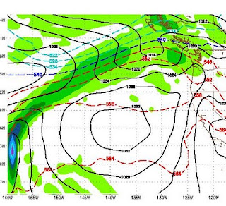
Giant Cold Front for this Weekend We are going to see some very cool temps this weekend as a strong storm that is slamming the Pacific Northwest moves on shore. The backside of that storm is going to whip northwest winds down the coast and right into our area. The high for Reno on Saturday will probably not get out of the 40's. There will be some light snow associated with this cold front. Here is a look at Saturday's weather. Take note of the black lines as they form a corridor straight out of the north. The blue circle represents a very significant cold front for this time of year: Strong and Frequent Storms for Next Week The weather models are predicting a very stormy pattern for next week. A series of moderate storms are headed our way. This will mean more mountain snow. Incidentally, I am not aware of a ski area still open in Tahoe. Many closed with a 15 foot base. Mammoth is still open and they continue to have unbelievable May conditions. Here is what we are look

Weather to Turn Stormy and Windy

Image
The headline says it all. We have a decent sized storm coming into the area late Sunday and lasting until midday Tuesday. This will bring some rain to the valley and a decent amount of snow to the mountains around Lake Tahoe. Here is a snapshot for Monday evening: Along with the stormy weather we will have much cooler temperatures and very windy conditions. Both Sunday and Monday will see wind gusts in the 50mph range. Next Friday, ahead of another storm, winds could be clocked in the 60-70mph range. Everyday for the next couple of weeks should have very windy conditions. Temperatures will vary as a number of storms enter and exit our region. Ahead of the systems, we will see reasonably warm temperatures. When the systems exit the temp will drop significantly. The models are tracking a much larger storm for a week from Monday. Of course that is very far off, but here is what they see for May 17: This is a very large storm for this time of year and could bring copious amounts of

Ugly Forecast

Image
High's in the 50's and Low 60's For At Least a Week Did I mention how difficult it is to forecast weather this time of year, especially with El Nino sitting out there stirring up trouble? Well, in complete defiance of my Friday post, which called for nice weather ... things have changed rather dramatically. Enjoy today, because this will be as nice as it gets. You will notice the winds start to kick up this afternoon, then our weather will be heavily influenced from the north. Which means cool temperatures and very windy ... for perhaps the next 12 days. This all culminates a week from today with what appears to be a pretty impressive storm for our area. We could see heavy mountain snows and valley rain. Here is snapshot for next Monday: If this holds, that is quite impressive for this time of year. Remember, however, things can change. Windy Windy and more Windy We should have decent winds every day into the foreseeable future. High winds (50mph +) are forecast for

Ridge City Coming - That Means More Mild, Seasonal Weather

Image
Two strong high pressure ridges are headed our way. Golfers and warm weather lovers rejoice. The first builds in late Saturday into Sunday. The following image shows the ridge off the coast of California. Notice how all the stormy weather bounces off the ridge and moves around it: Eventually this ridge breaks down and moves on. However, almost immediately after that, another stronger ridge will build in almost the same spot. Here is a snapshot for a week from Saturday: For you warm weather lovers, this should bring some 80's to the region. Between these high pressure ridges, we will see some wind but nothing like we have seen for the last month. There is little or no chance of significant precipitation for at least the next 10 days as temperatures will warm, fall off slightly and then get even warmer. For you skiers and riders, today Scott and I went up to Alpine Meadows and caught fresh lines for at least 3 hours. Although the snow was variable and dependent on the elevati

April Storms Continue

Image
Squaw Valley Could Exceed 150" in less than 30 days of Late March and April! You can literally read my last post which was last week and expect almost the same exact weather this week. It is truly amazing. The only difference is this storm is larger and it will be even colder. The models are in agreement that starting tomorrow morning the snows will begin in the Sierra and they should last through Wednesday when the cold front comes through and pulls in the real cold stuff. This is more of a Tahoe event than a Mammoth event. Some areas along the west short of Tahoe could pick up 4 inches of liquid precip. That could translate into 3-5 feet of snow. Our temperatures will begin to recover around next Saturday where there are some indications that we could see some stable weather with high pressure building in. That could last around a week and could bring us some 80's before the next series of storms arrives around the 10th of May. Man Made Global Warming Statement I h

Hope You Enjoyed The Nice Weather

Image
Mt. Rose closed too early this year. A large storm is headed our way for this week and our weather will be stormy for about another week or more. I talked about this pattern in my last two posts and it is a typical spring pattern in an El Nino year. Here is a quick look at Tuesday morning. This should system should produce 1.5 to 3 inches of liquid precip. Translated that will be 1-3 feet of snow for the Sierra: I apologize for not posting this earlier, but I have been out of town. For those of you looking forward to more hospitable golf weather, there are indications that May might come in like a lamb after this very turbulent April. However, the real stable weather will not show up until well into June I expect.

Decent Sized Storm, On Our Doorstep

Image
The storm I talked about last weekend has arrived and is knocking on the door. It is currently located about 500 miles west of Oregon. It will continue to move east until it hits the coast and then head south down the coast until it swings inland Sunday into Monday. The models are not totally in agreement with this system. There is a chance it could split with the bulk of the energy going down to the south central Sierra. However I am going to go out on a limb and predict this storm holds together and comes into the Sierra somewhere between Tahoe and Mammoth. This is not a huge storm but will produce some pretty decent precipitation in the Sierra just in time for Nevada spring break. The Accumodel shows about 1-2 inches of liquid precip for the Tahoe Sierra, with some areas around Mammoth receiving 2+ inches: I believe the storm will move slightly north and bring about 1-2 feet of precip to the High Sierra with around a foot for Mt. Rose by late Monday. Here is what the GFS weather

Midweek Clearing - Next Weekend Another Storm

Image
Shortwave city. Imagine a giant up in BC throwing snowballs down the coast and hitting us. That is what is taking place. A huge area of low pressure is firing off short waves of cold air. They travel down the coast, suck up the warm ocean water, hit the Sierra, rise, condense and dump. Some of the best skiing/riding conditions in the last 3 years as April comes in like a lion. I may well have underestimated our current short wave when I guessed 18-24 inches at Rose. I was up there around noon. Here is a picture of my daughter and what the weather looked like: She is  a good sport as the wind was howling around 50+ mph and snowing heavily. It took about 1 hour for conditions to turn to all powder. However, very slow lift and at the top it was a little hairy. This is supposed to continue until about 3:00 tomorrow afternoon. After that the weather looks nice around mid week with light winds and much warmer temps. But don't get used to that because it aint going to last. Next we

Mountain Snow Well Into Next Week

Image
A very large storm system that is centered well north of us continues to fire short wave patterns our way. The latest storm dumped nearly 30 inches at the top of Mt. Rose ski area. There is more coming. Tomorrow evening is shaping up for another bout of cold and snow, especially in the mountains. Should make for a great Saturday for the general public to get out. Here is a look at yesterday atop the mountain. The snow in the Mt. Rose Chutes ranged from 24 to perhaps 50 inches deep. A lot of snow blows in there and it was one of the better days of the year. This is Scott executing a heal turn and getting a face full: The steeps of Mt. Rose. I talked to the head avalanche forecaster for all of Tahoe and he claims that the chutes of Mt. Rose slide more frequently and violently than any other ski area in Tahoe. If you look closely, this next picture will show you why: The next short wave arrives Sunday. This is a larger system that could bring significant snow to the mountains and

Massive Cold Front To Dominate Our Weather - Dangerous Wind Gusts Likely

Image
There is a very large storm well north of us that will be sending some very cold air our way today, tomorrow and Wednesday. Along with that cold air, we could see our windiest conditions in a number of years, especially on the leeward side of the Sierra in the foothills. Places like Galena Forest and Arrow Creek. Accompanying this cold front is a pretty nice sized winter snow storm. It will spill over and snow all the way to the valley floor, heavy at times after the cold front comes through late Tuesday. Take a look at Tuesday afternoon: This snow event, which should bring 2-3 feet to the High Sierra, will last about 36 hours in the mountains. Here is a look at liquid precipitation levels: The western side of the Northern Sierra around Lake Tahoe could receive as much as 4 inches of liquid precip. Mt. Rose could get 18-24 inches of nice light powder from this event. Wednesday morning could be quite a treat for those of you who can make it up the mountain. Dangerous Winds Com

PNA Turning Positive, Weather Should Turn Nice

Image
The NOAA PNA is forecasted to go strong positive which should mean strong ridging off the coast and very nice weather for our area. Have a look: High Pressure will dominate our weather through next weekend. A weak system will come through tonight (Saturday) and another on Wednesday. High Pressure will setup to our south and west which will act as a blocking force and push the storms north. Expect highs in the 60's starting around next Thursday. For now it looks like a beautiful next weekend. Get those sticks (golf) out and start swinging as spring is here. Having said all that, we still have a moderate El Nino. Our pattern is going shift, but we have at least a couple more shifts back down the scale to prolonged stormy weather coming. There is an excellent base of snow out there. This is a great time of year to ride or ski in the morning and golf in the afternoon.

Stormy Week Ahead. Big Storms For Next Week?

Image
We have a series of small storms that will affect our weather over the course of the next week, starting on Tuesday. Another band comes through on Wednesday, Friday, Saturday and Sunday. We will then get a little reprieve before a much larger storm comes calling. All week looks excellent for riding and skiing conditions. On or around March 10, GFS has this storm slamming us. A similar storm could also hit us 3 days later: El Nino has weakened, but is still firmly in control of our weather. I would expect this to be a very turbulent spring with summer arriving late. As these storms approach from the Gulf of AK, I will keep an eye on them and report back to you!

Ready or Not, Here They Come

Image
The current pattern will continue for at least the next 10-15 days. There will be nice days surrounded by very stormy days. A very impressive storm is coming in Friday and Saturday that should dump 2-4 feet of snow in the Sierra. The NAM model shows this in the way of liquid precip, notice some areas of the Sierra could receive upwards of 4 inches, which could translate into 3 or more feet of snow:   Looking ahead, we will have a few nice days to start next week before the next system comes in late Tuesday through Wednesday. Looking way ahead, a series of larger storms appears poised to hit us starting Saturday, March 6th and possibly lasting through all of the following week ... but let's not get ahead of ourselves. These systems appear to be rain for the valleys. Couple that with warmer March weather, and the golf courses should be coming back online soon. Stay tuned ...

Nice Weather - Don't Get Used To It

Image
As I wrote about a week ago, things are looking really nice for this week. The valley's could start to push 70 by Wednesday or Thursday with sunny skies and reasonable winds. Enjoy it while it lasts, because it aint lasting long! A number of factors are starting to come together that should provide a fairly sustained period of very stormy weather starting this weekend and lasting into the foreseeable future. Without getting too detailed, the high pressure ridge will move east and the vacuum will be filled by a sub-tropical jet which will bring storms to all of California and the Sierra. Here is an interesting chart. This is the total precip from Sunday to Tuesday. Which should get a healthy shot, but look west. All that is heading our way as well:   Here is a look at a GFS chart for Sunday morning: The storm track should come right over Central California. Not getting too far ahead, a rather large storm looks poised to hit us on March 1, with several smaller storms co

Spring Like Weather Is Coming - El Nino has passed its Peak

We have a cold little system that will be moving through Tuesday and Wednesday. It will bring minor amounts of snowfall, < 12 inches for the Sierra. The models and the PNA forecast suggest that a weather pattern change is coming. That change is for much warmer, dryer conditions starting as soon as Thursday and lasting for perhaps a week or 10 days. There are some indications that a much larger storm could be in the works around the 20th of February. However, this year has been nearly impossible to predict weather. In fact the Reno NWS folks oftentimes have trouble predicting what will happen in 6 hours, let alone 2 weeks. I will keep an eye on that one. In the meantime, polish up those clubs as we could see some 60's not too far down the road. Meanwhile, NOAA is suggesting that El Nino passed it's peak in Late January and beginning to weaken across the entire equatorial Pacific, especially in the mid-pacific regions. The site when on to say that we should expect neutral co

Decent Storm for Friday and Saturday - Nino Coming Back mid-February

Image
Another decent sized storm is headed our way starting Thursday night and lasting through Saturday. There are a series of very weak disturbances that will come through leading up to this event. First here is a moisture chart for this weekends storm:   Most of the Sierra is poised to receive 1.5 to 3 inches of liquid precip. I should say this is the GFS model, which consistently under predicts moisture totals. My gut tells me the storm will produce around 18-36 inches of snow for most of the Tahoe Sierra, with a larger band down around Kirkwood. Here is a look at the storm as it approaches Thursday night. It is a decent sized storm coming ashore to our north: As it looks today, the best time to hit the pow will be on Saturday. But conditions should be excellent Friday through Monday, especially in the back country. Keep an eye on the avalanche conditions before setting out. You can check them here: Sierra Avalanche Center Looking longer range, the models are starting to point a

Next Storm Late Sunday and Monday

Image
We can officially say goodbye to the Pineapple express, for now. Take a look at the following Satellite picture compared to the prior post: Gone but not forgotten. We have some incredible conditions up and down the Sierra. Scott and i spent a day in the Chutes yesterday, and it was unbelievable. Here take a look: The snow was deep, the crowds small, the temps perfect ... and it was snowing hard. We talked with a ski patrolmen and he said the snow was perfect. According to him they threw bombs all over the chutes and everything held. When we got in there, it was waist deep in most places. Most of the rocks were covered up as well. This storm cycle is not quite over. If you look at the satellite image above, there is still a pretty strong storm out in the Pacific and it is headed our way. It will weaken and make shore north of us where it will split. It still should have some pretty good strength to send some moisture our way for Sunday night through Monday. The northern sectio

The Pineapple Express

Image
Oftentimes we have heard about a weather anomaly in Tahoe called the Pineapple express. That anomaly is a combination of many factors including the southern jet stream and sub tropical moisture plume. For the most part it represents a huge swath of precipitation stretching from Lake Tahoe all the way to Hawaii. Get the picture? No? Here take a look: This moisture is stretching a little too far north for us to see the epic storm conditions that normally happen in a Pineapple Express. Last Storm in The Cycle As you can clearly see, however, we are not done. In fact the largest storm is about to come in an blast us starting this afternoon and lasting through most of Thursday. This storm should bring us an additional 3-5 feet over the crest. That should translate to around 2-4 feet at Mt. Rose in the Carson Range. Believe it or not, the majority of energy for this storm is heading well south of us. We are on the northern edge of the storm. Here are the totals for this storm alone:

Wednesday Afternoon (1/20) through Thursday Night (1/21)

Image
In our continuing series analyzing the storms that appear stacked up and ready to pummel Tahoe and even, to a now greater extent, Southern California, we will look at Wednesday and Thursdays storm. As the super charged, 200+ kt Jet Stream moves south, so too do the track of the storms. There will be plenty of precip left for Northern California, just not as much as we once thought. First, let's take a look at total accumlated precip for the week, this is pretty impressive: Almost all of California is in the 5+ inch range. Like I said before many of highest elevations in the Sierra, especially the central Sierra around Mammoth and Yosemite will see 10-20 inches of precip. Now let's focus on Wednesday and Thursday. The good stuff will start around 4:00 pm on Wednesday and last through the night into the early hours of Thursday morning. There will be a short lull about 4:00am on Thursday until about 10:00am. Again, this might be a good morning to hit the pow. Then shortly

Tuesday (1/19) Afternoon's Storm

Image
In our continuing series we will talk about a single storm at a time. Right now there are at least a half dozen storms stacked up and ready to blast Tahoe. In today's installment, I will talk about Tuesday's storm. Before I do, Sunday/Monday's storm, appears to have actually gained strength. Tuesday's storm does appear to be the weakest in our series, at least for now. The really heavy stuff will start coming in late Tuesday afternoon. It should snow heavily in the mountains for around 12 hours. After that, we may get a short reprieve before another large storm comes in on Wednesday. Here is a look at Tuesday afternoon: This storm will actually split with half the energy moving into Southern California. The other half will pummel Tahoe. Here is a very interesting graphic. This is the total precipitation for the first two storms in our series. Notice the little white specs. Those are areas of 5-10 inches of liquid precip. There are very many places in the Sierra th

One Storm At a Time - 1/17 - 1/18

Image
Although a weak system will be coming through our area Saturday night, the first decent storm in what will become a long series of storms will hit our area Sunday Night through Monday. Here are precipitation predictions for that storm: As we can clearly see, most of the Sierra around Tahoe will pick up between 2-4 inches of liquid precipitation. Because the air will be cool, this will translate to between 3-4 feet of snow. That is for the Sierra Crest on the West side of Lake Tahoe moving south. The Carson Range, on the east side of Lake Tahoe, could receive from 1-3 feet of snow. This storm will come in two bursts. The first will be Sunday night starting around 10:00. Then another burst will come in Monday night into Tuesday. The next storm will hit our area Tuesday (1/19), with another on Thursday (1/21). The storm on Thursday looks really impressive. I will talk about these two storms in my next post. Stay tuned ...

The Perfect Storm III

Image
First let me say that today's storm has gained strength and moisture. Should be a decent snow event for the Sierra, including the Carson Range. I guess about 18 inches will fall up at Rose. All snow, despite the high levels. This will be all rain for the valley. That should melt most of the remainder of the snow and start to open the golf courses again. Let's talk about next week. If the weather models have it right, this could be the stormiest week I have ever seen since moving here. There are storms literally stacked up for 10 days. Pineapple express? Perhaps. Let's take a little closer look. First, the PNA is moving negative. This is a sure sign of conditions being ripe for stormy weather. Here is the latest NOAA run: The following are GFS predictions for next week, please notice the days: Monday (1/18) Late Tuesday (1/19)    Early Thursday (1/21) Early Saturday (1/23)  Sunday Afternoon (1/24) Tuesday Morning (1/25) I could keep going b

Storm on Track For Tuesday and Wednesday

Image
The storm has held together and the conditions are becoming much more ripe for a change in our pattern starting on Monday Afternoon. NOAA has the PNA index moving negative, that is a change. The huge cold front that was blocking everything has moved on ... that is another positive change. El Nino is picking up strength and should begin to have a tremendous impact on our weather. The majority of this system will be arriving on Tuesday. Wednesday would appear to be the powder day on the mountain. However it should be snowing all day on Tuesday. Snow levels will start fairly high 7,500 feet, and drop as the system moves through. I do not see any valley snow. But this storm is tiny compared to what is coming in for the following week. There will be some more weak systems move through next weekend. The following week is shaping up to be a very stormy week with some of the more impressive moisture contents I have seen. Here is what GFS says will happen Janary 20: This is the first of

Pattern Shift Slowly Coming

The models have backed off a drastic pattern shift for next week, however there is a slow shift coming. Next week should bring in a pretty decent storm Monday and Tuesday with at least a foot of snow for the Sierra. The bigger shift will come later in the month as a number of indicators should allow the jet to move storms back through our area. If you live in the east, the massive cold front will break down and finally move on. That should open the door for weather to change in our area too. Truly amazing is our current pattern as the massive ridge to the SW and massive storm to the NW have not moved in about 10 days. Everything is just stuck. That should change, but it won't happen for at least another week and probably closer to two weeks. That means crap air for the valley with more deep inversions and weak pockets of energy coming through about every 4 days. The air down there is terrible right now. However, tomorrow should clear at least some of it out as a weak trough wil